

NoMi Trails
Sophomore project
Spring 2020
Mckinley Kreitner
A community health center in Northern Michigan wanted to create a media rich application to help inform, educate, and entice the people of Northern Michigan to go out and discover their local trails. With providing community members with this tool, the health center aims to improve overall community health as individuals start to gain the health benefits that associated with nature.
In addition to client goals, there was also a user narrative to consider while crafting this application. The user expressed that they want a way to easily access information about local parks and trails, as well as track their outdoor activity, so her and her family can enjoy spending time outdoors.
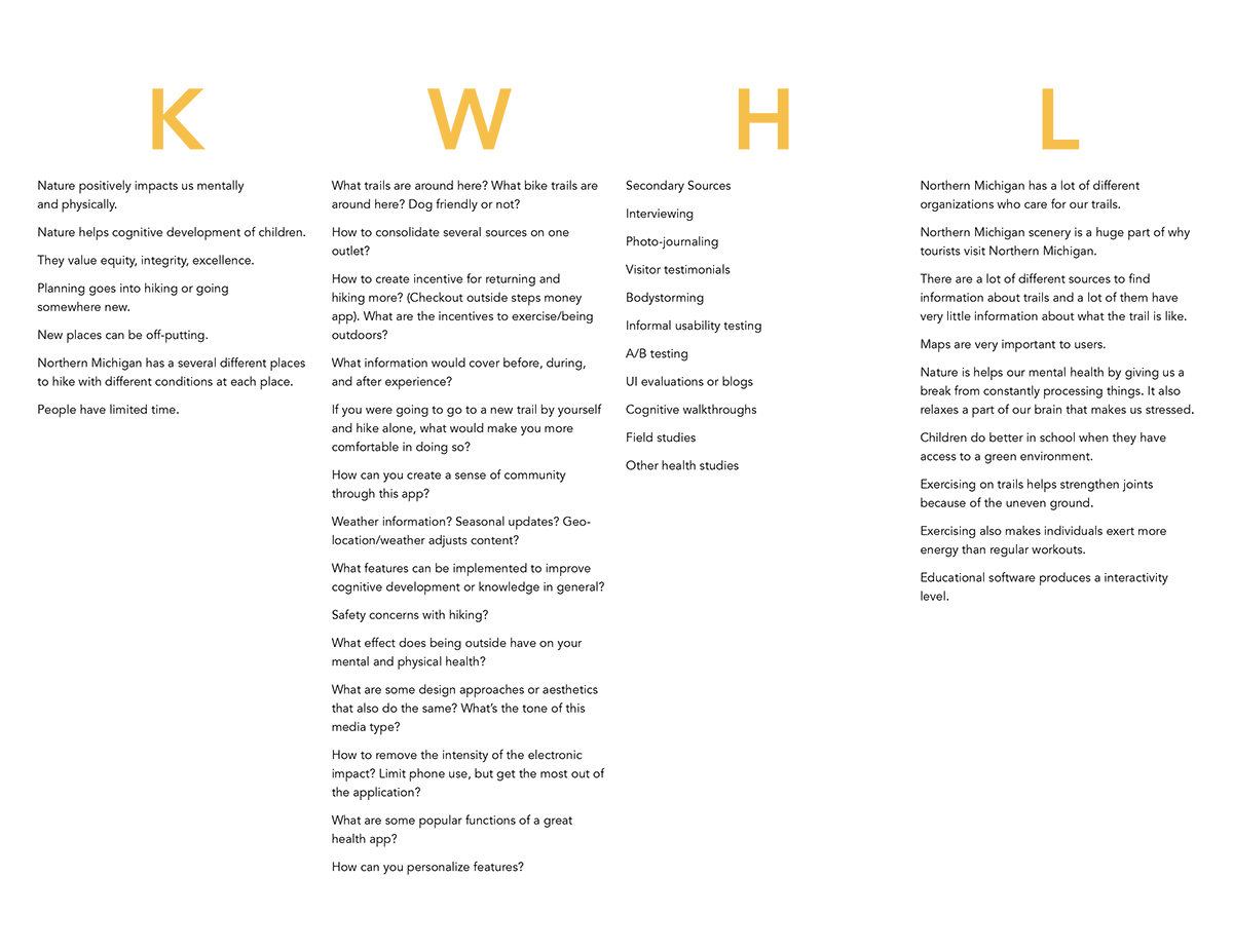 Creating this KWHL helped direct what forms of primary and secondary research I needed to gather in order to create an application that would meet the needs of the content owner and the user.
 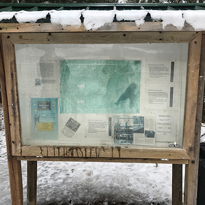 The first primary research method I conducted was photojournaling my own experience at a local trail in order to understand the factors that can impact someone’s experience hiking on a Northern Michigan.
 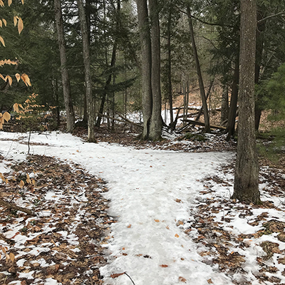 In this image I noticed there was not enough trail markers to understand which path you should take. An insight that I got from this experience was that it is important to improve wayfinding systems in trails to make people more confident with exploring areas they have never been to before.
 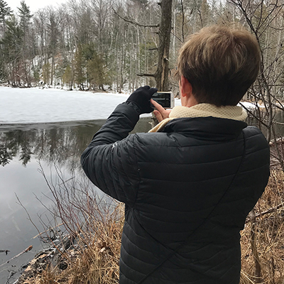 In addition to photojournaling, I conducted an interview to gain another perspective of what is important to others when they are going to go out and hike.
 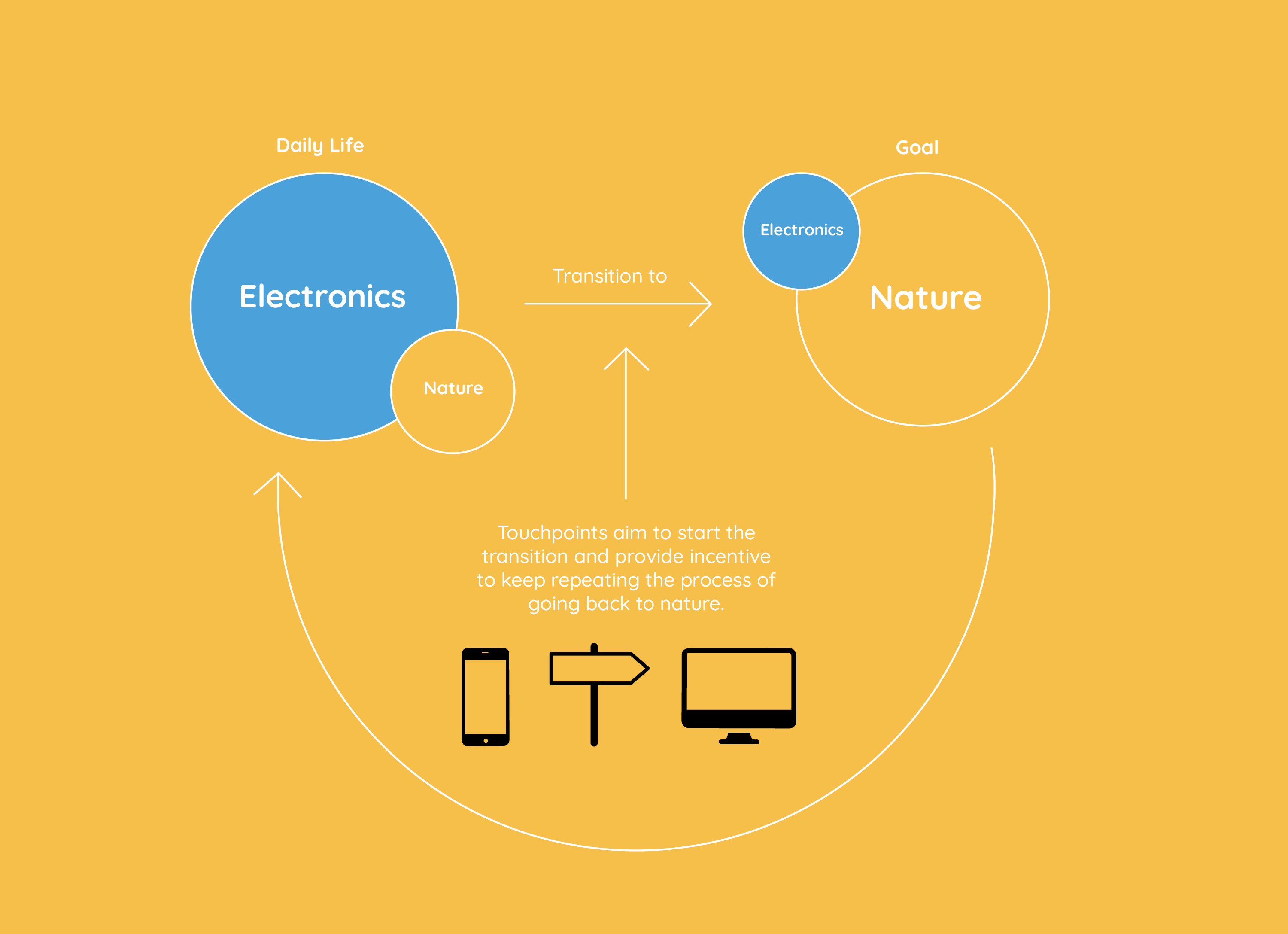 After compiling insights and opportunities from my primary and secondary research, I created a high-level concept map of how the solutions I am going to create play a role in the overall experience. This map depicts that my solutions aim to not become the whole experience, but to provide incentive and confidence for people to engage with nature.
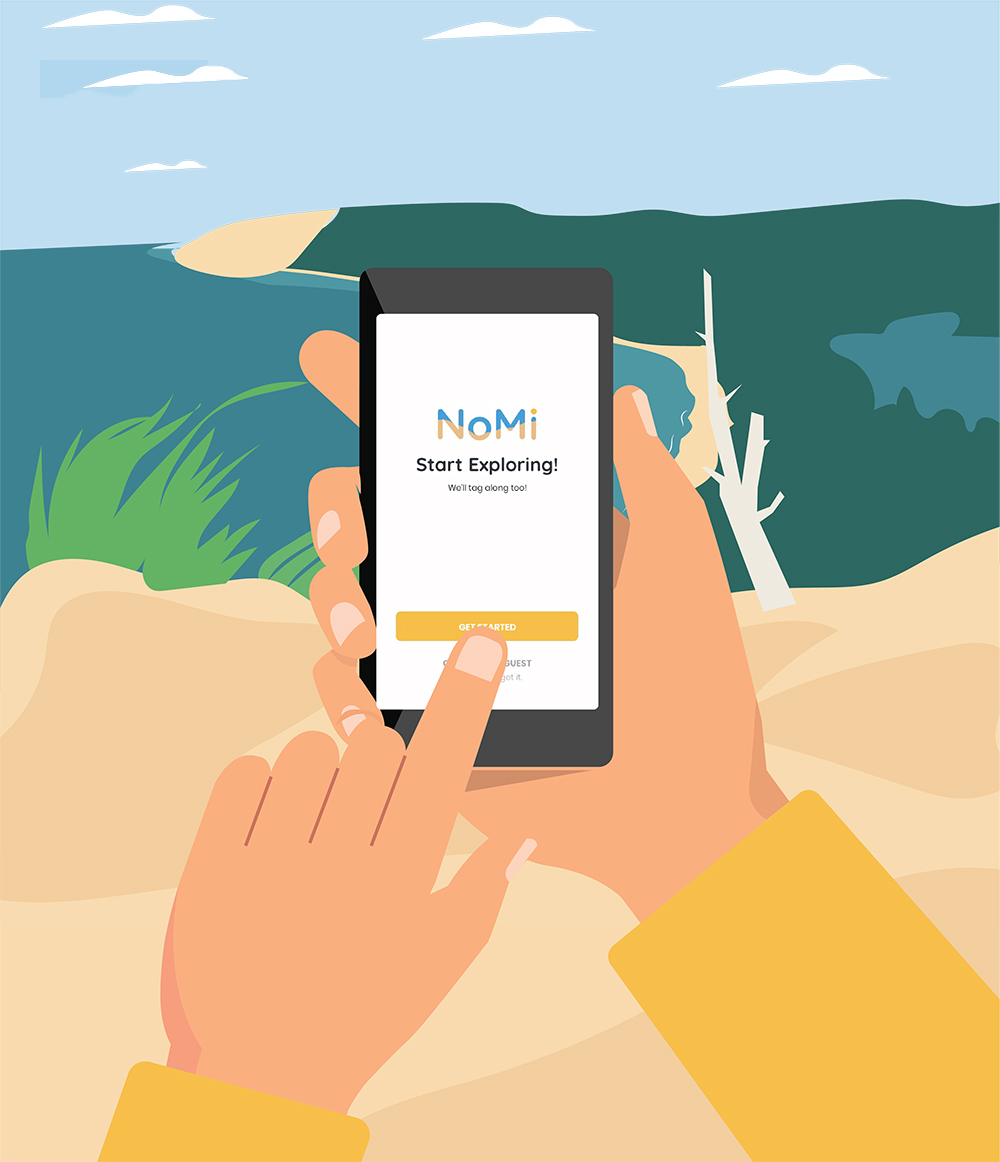
 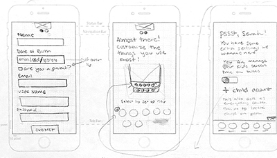 After creating a concept I moved into creating several low fidelity prototypes of how certain features of the application would work. These sketches show the onboarding process of the app.
 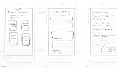 These sketches show how children can select and play games to learn more about the trails they are on.
 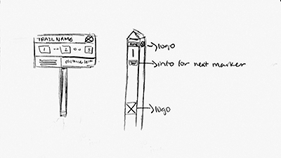 Lastly, these are a few sketches of how trail markers can be redesigned to help those navigate trails even without incorporating technology at all into their physical experience.
 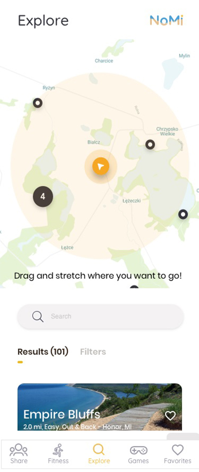 This is the final screen of the explore section of the application that will help users search for trails around them from wherever they are in Northern Michigan.
 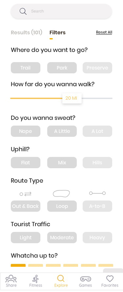 Users can filter trails based on their needs. They can filter by trail attributes, activities they would like to do, fitness goals, and special accommodations they would need.
 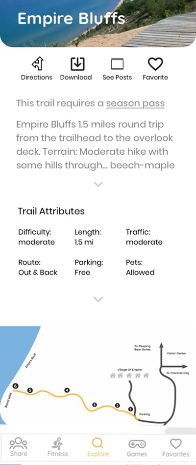 This is some of the information that is displayed for every trail. They have the ability to download maps to stay confident if they lose service. They also have access to how this trail can improve their health by describing how the terrain can improve specific muscles.
 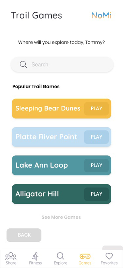 In order to encourage education about local trails and provide incentive for children to head outdoors, children have the ability to play interactive games specific to the trail they are on.
 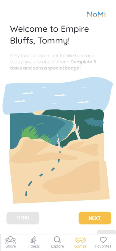 Each game features an illustrative style and represents characteristics of the physical trail they are on.
 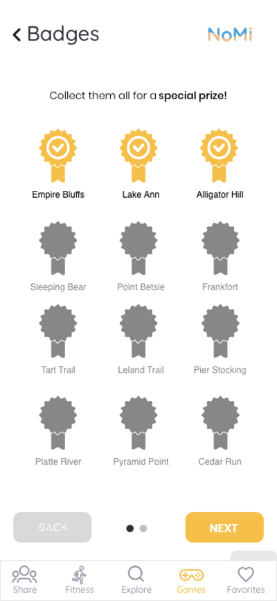 Once they have completed a game they earn a badge. This helps them keep track of the trails they have been to and ones they still have yet to explore.
 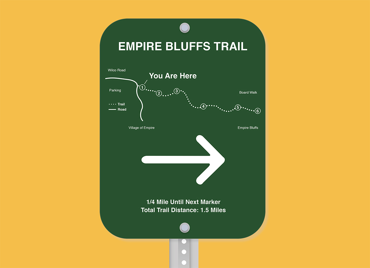 This is the final designed for trail markers that would be placed all around Northern Michigan Trails. It is made out of aluminum so it would last through the seasonal weather conditions as well as maintain readability longer than the preexisting wooden signs.